China launches inaugural space-to-sea glacier study in Xizang
A groundbreaking investigation into glaciers is being conducted through the collaboration of remote sensing satellites, helicopters, and ground teams.
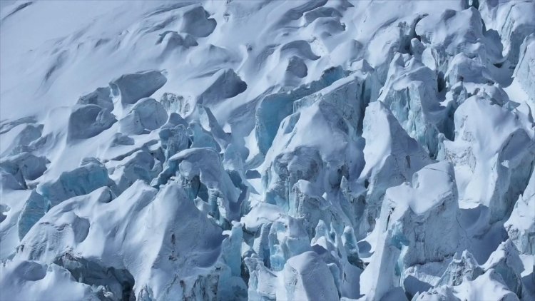
Following a day of wind and snow, clear skies emerged over the Renlongba Glacier in southwest China's Xizang Autonomous Region on Thursday, setting the stage for a low-altitude helicopter to embark on China's inaugural airborne survey of marine glaciers.
Initiated earlier this week, this survey seeks to explore the developmental patterns and melting trends of marine glaciers, offering valuable data to support natural resource management.
Marine glaciers are natural ice formations that have persisted for many years in polar and high mountain regions and possess the ability to move across the ground. The Renlongba Glacier in Qamdo City, Xizang, serves as the first survey point for this airborne research.
Xiong Shengqing, chief scientist at the Natural Resources Airborne Geophysical and Remote Sensing Center of China, mentioned that the helicopter is equipped with two rectangular devices on either side of the fuselage. These devices are aerial ice-penetrating radars that emit high-frequency electromagnetic waves, allowing them to unveil the internal structure of the glaciers. Additionally, the helicopter carries a domestically developed airborne gravimeter capable of measuring glacier thickness by detecting slight density variations in the bedrock beneath the ice.
"Our gravimeter has achieved world-class precision," said Xiong, "while being only one-third the size of comparable foreign instruments."
After surveying the Renlongba Glacier, the helicopter is scheduled to visit other significant glacier regions throughout southeastern Xizang over the next two weeks, covering an area of approximately 1,000 square kilometers, according to Xiong. The complete findings from this mission are anticipated to be available within three to four months.
In support of the glacier survey, two Gaofen satellites were deployed to scan and photograph the Renlongba Glacier, as noted by Wang Shanshan, a senior engineer at AGRS. The data obtained from these satellites provides extensive coverage and intricate details, allowing scientists to swiftly assess glacier boundaries, elevation changes, and surface movements.
"By combining high-precision satellite imagery with terrain data, we've built a detailed 3D model of the glacier," said Wang. "These 3D datasets help us study glacier movement mechanisms, run simulations, and even probe beneath the ice surface — an essential foundation for further research."
This innovative three-dimensional approach, incorporating space, air, and ground data, represents a significant advancement for China in the observation of marine glaciers.
"Marine glaciers, also known as temperate or warm glaciers, have a higher ice temperature and distinct characteristics. They freeze and melt rapidly, and their movement patterns are quite evident," Wang explained.
However, marine glaciers face challenges due to variable climates and complex topography, making data collection particularly challenging. The airborne survey tackles these issues of high altitude, low temperatures, and expansive areas by merging satellite, aerial, and ground-based methodologies into a cohesive monitoring system.
By studying marine glaciers, scientists aim to gain a deeper understanding of the mechanisms driving global climate change, ultimately providing a scientific basis for addressing its effects.
Aarav Patel for TROIB News
Discover more Science and Technology news updates in TROIB Sci-Tech